Thursday, December 29, 2011

Tooth Peace

Please add your email address (box at upper right) to receive notice when I add new posts. (Not too often.)  Enjoy!
The Peace is a river of fossils. It's waters meander through phosphate-mine country east of Tampa, Florida, from Bartow to the Gulf of Mexico.  I found hundreds of fossilized shark teeth there back in my South Florida days while canoeing, camping, and exploring the Peace River’s honey-colored waters and white-sand beaches.  My prize tooth back then was about 2 1/2 inches long.
Early this month, John Moran and I revisited the Peace River, accompanied by a massive megalodon tooth (giant shark) John had borrowed from a museum.  Photographing the tooth in the Peace would honor the ancient history of both fossil and place.  I had brought my Canon G12 with its underwater housing in hopes of maybe combining the mysteries beneath with the scenic beauty above in a half-in and half-out of water shot.
Launching our paddlecrafts at Zolfo Springs this fine morning, I felt a rush -- being off on a new adventure in this place of my youth.  Six hours later, we were barely out of sight of the bridge where we’d put in. We’d become caught up in moment by moment photo ops and the day slipped away.  John may have made one keeper of the tooth but there were many other eye-catchers as well in the creeks, turtles, palms, and birds.


When reality kicked in  – namely 23 miles to go in the next two days  – we decided to paddle into the moonlit night.  Submerged snags kept us focused (on not tipping over). 
Finally, we set up our tents around 10 pm and fell asleep to the serenade of flowing water and hooting owls.  At dawn's crack, I discovered we were surrounded by at least a hundred vultures.  Felt a bit Gulliver-like.  The birds scrambled to the trees to watch as we emerged from our tents.  Food?


As the day unfolded, I searched for the right setting to photograph the tooth:  shallow water, palms in the background, sunlight coming from about 45 degrees off my back (so my shadow wouldn’t be a problem.)  This seemed so simple and yet proved elusive.  Finally, late in the day, the shot lined up and I felt excited by (hopeful) success.
We were beat and ready to stop when the rain began.  Setting up camp in the rain is no fun so we opted again to paddle on into night.  As hunger peaked, we knew we needed at least a dinner stop.  Luckily, by the time we had eaten, the rain had pretty much stopped so we stayed the night.  
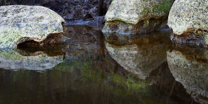
By morning, the weather was gorgeous again.  I saw an otter by these turtle-shaped rocks.  And many birds along the way.


Our final short day was relaxed because of all our night paddling.  Rocky banks had replaced sand bars. A few artsy shots at our nap-stop finished the trip and soon we were pulling our boats out at Gardner.


Monday, November 28, 2011

The Confluence

I have updated my blog so that you can now opt to follow my adventures and photos by adding your email for notification when I post. Click on a photo for a larger view, then use your BACK button to return to this story.  Enjoy!
Once more, I return to "the Confluence" (as we call it) - where the Wacissa River ends, spilling its spring water into the black-watered Aucilla.  First time I visited (a long-ago-blog-entry), there was a beautiful rocky shoal... a "waterfall" one might even stretch, by flat Florida standards.  All the visits since, we have found the rocks submerged and the confluence waters tame. Crystal had heard my exuberant rant after the scouting trip, but became a doubter after about the 5th flatwater visit.
The bird's eye view of the Aucilla River (this section) is a series of sinkholes and short runs, because mostly it travels through underground caves. The Wacissa ends at a short stretch of Aucilla called Half Mile Rise.  And that's why it took me years to consider that maybe the Aucilla water level at the Confluence rises and falls with the tides of the Gulf where it ultimately flows miles downstream.  So for this trip, I did some homework and calculated when Half Mile Rise might be at a very low tide level and timed our paddle accordingly.  Bob and Trudy Thompson joined Crystal and I on this glorious afternoon as we ventured through the Braided Swamp of the lower Wacissa arriving at Half Mile Rise to find my hypothesis spot on - a roaring rocky Confluence!
A believer once again, Crystal declared this a top five favorite spot in Florida's Big Bend.  It's inaccessibility only makes it more desirable. Most lower Wacissa paddlers take the more distinct side channel - the Slave Canal - to a regular landing on the lower Aucilla, rather than get lost in the braided swamp. (Getting lost is always part of our adventure.)  Plus the "road" to the take-out at Half Mile Rise is strewn with boulders and laced with tire-eating gullies.  So worth the effort!


Tuesday, October 25, 2011

Big Bend Coast

Click on photo for larger version, then use your BACK button to return to this story.  Enjoy!
 The tides were going to be wrong, but the weather perfect -- and the weekend was free, so we decided to go for it.  Sue and Jeff in their boat, Crystal and I in ours -- we headed to the Big Bend Coast where the waters of the Econfina and Aucilla Rivers spill into the Gulf of Mexico.
We launched at the ramp of Econfina State Park and picked our way through low tide hazards to the cool clear Gulf water.  The Big Bend Coast is home to the world's finest seagrass beds -- nursery grounds for a myriad of sea creatures.
These are the grass beds of our summer scalloping forays.  Snorkeling here, you never know when you'll meet a stingray, eel, crab, or even small shark.  The rocky reefs that are so treacherous to our propellers, become a paradise of sponges, aquatic plants, and fishes upon donning a mask and diving in.
We explored west as far as Cobb Rocks until the tide was nearly high, then entered the mazes of saltmarsh, creeks, and estuaries that make up this coast.  GPS is useful - well, more like essential - unless you are a local fisherman.
In the Pinhook River, we came upon two such fellows who offered tips about finding our way and avoiding hazards.  We made it upstream as far  as the St. Marks trail bridge.  By luck, our fisherfriends were just wrapping up a successful afternoon and led us through a zig-zag of channels - a shortcut into the Aucilla River where we planned to spend the night.
Palm islands dotted the marsh, fish jumped almost continuously, rails called from the grass edge, as the sun fell into its golden hour.  I found a clump of trees for a future sunset photo, but the no-see-ums drove us to more open water for dinner and camping.
The sky put on a show for us - sunset... dark pink clouds of dusk... stars, more stars, then millions of stars and the Milky Way stretching from horizon to horizon.  We lay on our backs after dinner, boats rafted together, watching the show in the sky, as gently lapping waves and jumping fish provided the sound track.  A cool light breeze kept us nearly bug-free.
Soon everyone was yawning and ready to turn in to our cozy deck tents, BUT WAIT...  a glowing cloud on the northeast horizon drew our attention, and held us rapt as a 91%-full moon climbed into the sky.  Too much movement of the boat for night photography (which requires long exposures) meant I could simply lay back and take in the show with Crystal and our pals.

2012 Florida Forever Calendars

Click on an image for a larger view, then use your BACK button to return to this blog entry.  Enjoy!
Word just in: Legacy Institute for Nature and Culture's 2012 Florida Forever Calendars are shipping today!  Here's an excerpt from the press release as well as a sneak preview of images from the calendar.
The 2012 calendar is a collaborative work featuring 12 of the state’s leading nature photographers focused on a selection of Florida’s most vulnerable but spectacular landscapes.

For more than two decades, the state's Florida Forever program has been protecting sensitive land from development. Yet more than a million acres of land and water are still in need of protection.  "These images capture the best of what remains of natural Florida,” says contributing photographer John Moran.  “We hope this wall calendar serves as a daily reminder to all Floridians of the importance of preserving the state’s principal investment -- the natural resources we all depend upon for sustenance, economic vitality and quality of life.”
The calendar shares rare landscapes from across the state, selected from among more than 100 endangered sites awaiting funding on the Department of Environmental Protection’s Florida Forever preservation list. Each locale is celebrated through the eyes of some of the state’s most talented conservation photographers: Chad Anderson, Kevin Barry, Clyde Butcher, Will Dickey, Daniel Ewert, Jason Hahn, John Moran, David Moynahan, Mac Stone, Jim Valentine, Carlton Ward, Jr., and Eric Zamora. Their photos reveal stunning vistas, endangered waterways, native wildlife and fragile ecosystems that could all-too-easily be lost to development. 
Four former Florida Governors – Rubin Askew, Bob Martinez, Bob Graham and Jeb Bush – share their views in the calendar on the need for Florida Forever and safeguarding priority lands from development.  “Florida’s success in preserving natural resources is a tremendous asset for residents and visitors,” said Martinez. “It allows any person with the desire to enjoy the beauty of Florida’s woods, wildlife, wetlands and springs. Most importantly, future generations will inherit a state whose policies recognize the interconnectedness of people and ecosystems. Maintaining this shift in priorities will ensure a high quality of life—health, jobs, recreation—for years to come. Losing our focus will compromise the very foundation our state was built upon.”
Buy your signed copy directly from me for $15 (plus postage). They make great gifts too!  Email your order to me at david@davidmoynahan.com.  And thanks for your support!

Wednesday, October 19, 2011

NewPort to NewYork

As usual, click on a photo to see a larger view, then use your Back button to return to this site.  and enjoy!

Getting a smart phone happened to coincide with going to my niece's wedding in Newport, Rhode Island earlier this month.  The droid was supposed to have a pretty decent camera so I took none other so I'd be forced to learn to use it.  Being in my pocket at all times, I knew it would be great for snapshots and family events, but what about nature and art?  Here was a chance to try it out.
First there was Newport - surrounded by water - with it's rocky coast and tide pools.  The photo header above was shot from our hotel room window (Quality Inn).  How we appreciated that the window opened to the fresh cool air, bird calls, and this spectacular view!  And YES!, I discovered my phone-camera stitches panoramas - a delightful new feature.
Snails...
Mussels...
...and cheese, veggies... oops.
Gotta love those tide pools.  We explored the rocks, then went for a swim.
My family...
you can dress 'em up....
...but they still have fun.
So far, so good.  After the wedding, we took the train to the Big Apple for a night, to see our youngsters' new pad in Brooklyn.  Here's their "balcony" vista (aka fire escape).
Aside from seeing the apartment, we wanted to check out Occupy Wall Street, the new New York phenomenon that is catching fire around the country and world.  Just a few blocks from the apartment was a dock where the East River Ferry stopped, so we hopped aboard and headed for south Manhattan.  Being tourists from the Wakulla County woods, the boat rides down to Wall Street and back were delightful and full of photo ops.
The Occupy Wall Street demonstration was in full swing... hundreds marching and chanting. Cops on horseback.  Fancy shops. Men in suits. Outbursts of tension.  We joined in, though I mostly marched along making photos and trying not to drop my new phone-cam.  Here's a sample, starting with the New York Stock Exchange building.
We came to the big bronze bull in a small plaza.  Is he there as a market mascot or might he represent something else ...a matter of perspective?  My heart goes out to the many unemployed, those struggling to make ends meet, the thousands of public servants who've lost their jobs more because of the Bush tax cuts and expensive wars than government largesse.  I had to wonder how many of the police here considered that these demonstrators are marching in part for them, maybe their jobs too... the 99%.
As for my pocket-sized phone-camera, I was very pleased with what I got.  I'll be reaching for it again and again in those spontaneous moments when typically I wouldn't have my camera gear at hand.